ACR SkyTech provides professional LiDAR terrain mapping NJ for civil engineering and land development. We deliver survey ready data with sub 3cm vertical accuracy to support precise site design.
Fill out the short form below and a member of our team will get back to you with a custom quote.
Accuracy
FAA Compliance
Average Turnaround Time
Mapping Formats Supported
We deliver survey-support data for complex or heavily wooded sites. High-density point clouds provide clean ground-point classification and 1ft contours for Civil 3D import. Every mission includes a comprehensive Accuracy Report verified against your site monuments. We guarantee survey-grade deliverables that meet your requirements or the mission is on us.
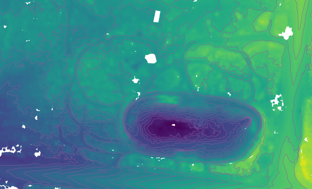
Replace manual estimates with technical volume reporting. We compare active site LiDAR scans against your design surfaces to calculate precise cut/fill requirements and stockpile totals for accurate subcontractor billing. Every report includes a TIN surface comparison to ensure your project stays on grade and within budget.
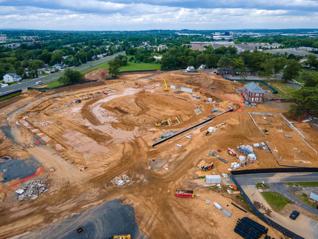
We provide high-fidelity as-builts using a combined LiDAR and photogrammetry workflow to deliver absolute geometric truth with visual clarity. This hybrid approach ensures that structural elevations are sub-3cm accurate while providing high-resolution 3D mesh models and orthomosaics for project handoff and asset management. By merging point cloud density with photographic detail, we create a complete digital twin of your finished site.
-Establish ground control points (GCPs) to ensure data precision. -Align with your project Coordinate Reference System (CRS). -Tie all data directly to existing site monuments.
-Execute precision flight paths using hybrid LiDAR and photogrammetry. -Capture high-density point clouds for terrain modeling. -Secure high-resolution visual records for asset documentation.
-Process data into .LAS, .DWG, and .TIF formats. -Deliver comprehensive RMSE Accuracy Reports with every project. -Guarantee sub-3cm vertical accuracy for engineering support.
ACR SkyTech provides high-density LiDAR and geospatial data for NJ infrastructure projects. We prioritize accuracy and project schedules for industrial sites.
Fill out the short form below and a member of our team will get back to you with a custom quote.